Challenging Runways
About this tour
Challenging Runways
With high altitudes, short runways and numerous challenging approaches, this tour is for you. This tour is not for the fainthearted!
This is a tour of 10,607 nm (19,645 km) divided into nineteen legs.
To complete this tour, you will need to fly at least one route of each of the legs listed below.
Map
Leg 1: MSLP - MHTG
ExpandThe airport has an extremely short runway—and mountainous surroundingS, Honduras. The approach to the airport is considered to be one of the most difficult in the world to all aircraft, especially in inclement weather conditions.
This is a leg of 114 nm (211 km) from El Salvador International Airport (SAL/MSLP) (Hub) to Toncontín International Airport (TGU/MHTG) .
Eligible routes
Choose any one of the routes below.
Leg 2: RKPK - RJGG
ExpandThe Airport is surrounded by water and that makes it difficult to land.
This is a leg of 388 nm (718 km) from Gimhae International Airport (PUS/RKPK) (Hub) to Chubu Centrair International Airport (NGO/RJGG) .
Eligible routes
Choose any one of the routes below.
Leg 3: LPPR - LPMA
ExpandThe airport was once infamous for its short runway which, surrounded by high mountains and the ocean, made it a tricky landing for even the most experienced of pilots. It is still considered one of the most dangerous airports in the world.
This is a leg of 643 nm (1,191 km) from Francisco de Sá Carneiro Airport (OPO/LPPR) (Hub) to Madeira Airport (FNC/LPMA) .
Eligible routes
Choose any one of the routes below.
Leg 4: RJCC - RJBB
ExpandApproaching the runaway feels like your pilot is about to land on water.
This is a leg of 585 nm (1,084 km) from New Chitose Airport (CTS/RJCC) (Hub) to Kansai International Airport (KIX/RJBB) (Hub) .
Eligible routes
Choose any one of the routes below.
| Flight Number | Departure Time | Arrival Time | Duration | Aircraft Models | Actions |
|---|---|---|---|---|---|
| APJ102 | 01:20z | 03:40z | 2:20 | A320 | |
| APJ120 | 11:10z | 13:30z | 2:20 | A320 A20N | |
| APJ110 | 06:15z | 08:35z | 2:20 | A320 A20N | |
| APJ118 | 10:10z | 12:30z | 2:20 | A20N | |
| APJ104 | 02:10z | 04:30z | 2:20 | A320 A20N | |
| APJ112 | 07:15z | 09:35z | 2:20 | A320 A20N | |
| APJ108 | 04:45z | 07:05z | 2:20 | A320 A20N |
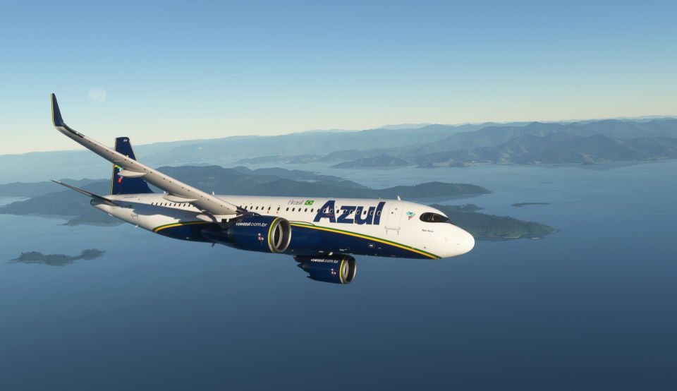
Leg 5: SBCF - SBSP
ExpandLocated in the middle of Sao Paulo, Brazil airport is highly challenging .
This is a leg of 283 nm (525 km) from Tancredo Neves International Airport (CNF/SBCF) (Hub) to Congonhas Airport (CGH/SBSP) .
Eligible routes
Choose any one of the routes below.
| Flight Number | Departure Time | Arrival Time | Duration | Aircraft Models | Actions |
|---|---|---|---|---|---|
| AZU4462 | 21:00z | 22:20z | 1:20 | E295 E195 | |
| AZU4201 | 20:30z | 21:55z | 1:25 | E295 | |
| AZU6503 | 16:50z | 18:10z | 1:20 | E295 | |
| AZU4351 | 19:15z | 20:40z | 1:25 | E195 | |
| AZU4455 | 00:00z | 01:25z | 1:25 | A20N | |
| AZU2636 | 11:10z | 12:35z | 1:25 | E295 E195 | |
| AZU6077 | 17:25z | 18:45z | 1:20 | E295 E195 | |
| AZU2952 | 22:15z | 23:40z | 1:25 | E295 | |
| AZU6415 | 16:40z | 18:00z | 1:20 | E195 | |
| AZU6415 | 14:50z | 16:10z | 1:20 | E295 | |
| AZU6027 | 19:30z | 20:55z | 1:25 | E195 | |
| AZU2790 | 19:30z | 20:50z | 1:20 | E295 | |
| AZU9802 | 18:08z | 19:16z | 1:08 | A20N | |
| AZU6419 | 19:05z | 20:25z | 1:20 | E295 E195 | |
| AZU6041 | 12:25z | 13:50z | 1:25 | E295 | |
| AZU6411 | 14:25z | 15:45z | 1:20 | E195 | |
| AZU4455 | 23:59z | 01:25z | 1:26 | A20N |
Leg 6: NZQN - NZWN
ExpandThe airport has a reputation for sometimes rough and turbulent landings, even in larger aircraft, due to the channelling effect of Cook Strait creating strong and gusty winds, especially in pre-frontal north westerly conditions.
This is a leg of 346 nm (641 km) from Queenstown International Airport (ZQN/NZQN) to Wellington International Airport (WLG/NZWN) (Hub) .
Eligible routes
Choose any one of the routes below.
Leg 7: MPTO - SEQM
ExpandA densely populated neighbourhood, a cramped runway, active volcanoes, and frequent fog make Quito’s high-altitude airport a threat for only a little longer; Ecuador’s main airport is going to be moved to an agricultural setting 12 miles (20km) northeast of the city.
This is a leg of 556 nm (1,030 km) from Tocumen International Airport (PTY/MPTO) (Hub) to Mariscal Sucre International Airport (UIO/SEQM) (Hub) .
Eligible routes
Choose any one of the routes below.
| Flight Number | Departure Time | Arrival Time | Duration | Aircraft Models | Actions |
|---|---|---|---|---|---|
| CMP211 | 03:31z | 05:34z | 2:03 | B738 B737 B39M B38M | |
| CMP159 | 20:29z | 22:32z | 2:03 | B738 B39M B38M | |
| CMP152 | 23:40z | 01:43z | 2:03 | B738 B38M | |
| CMP829 | 15:29z | 17:32z | 2:03 | B738 B737 B38M | |
| CMP428 | 02:30z | 04:33z | 2:03 | B738 B38M | |
| CMP714 | 17:06z | 19:09z | 2:03 | B738 B38M |
Leg 8: MPTO - TNCM
ExpandThe airport is perhaps best known for very low-altitude flyover landing approaches due to one end of its runway being extremely close to the shore and Maho Beach.
This is a leg of 1,091 nm (2,021 km) from Tocumen International Airport (PTY/MPTO) (Hub) to Princess Juliana International Airport (SXM/TNCM) .
Eligible routes
Choose any one of the routes below.
Leg 9: LEPA - LOWI
ExpandSituated in a valley surrounded by 9,000-foot mountains, Innsbruck is one of the most challenging airport approaches in Europe. Unlike most airports where traffic can be fed in by ATC from all directions, at Innsbruck, there’s only one way in and one way out. Depending on the wind direction, approaches start at one end of the valley. When the wind is coming from the west, pilots start the approach over the town of Rattenberg at the eastern end of the valley.
This is a leg of 596 nm (1,103 km) from Palma De Mallorca Airport (PMI/LEPA) to Innsbruck Airport (INN/LOWI) .
Eligible routes
Choose any one of the routes below.
Leg 10: MSLP - MMMX
Expandhen planning for an approach, pilots identify the threats using “The 6 Ts” — terrain, thunderstorms, track miles, traffic, tailwinds and Air Traffic Control (yeah, the last one is a bit of a fudge!). Whereas most airports will only have a few of these, Mexico City has them all.
This is a leg of 680 nm (1,259 km) from El Salvador International Airport (SAL/MSLP) (Hub) to Benito Juárez International Airport (MEX/MMMX) (Hub) .
Eligible routes
Choose any one of the routes below.
Leg 11: SBBR - SBRJ
ExpandIf you’ve been to Rio or have just seen photos of the city, you’ll have noticed that the coastline is quite mountainous. Sugarloaf Mountain blocks a straight in approach to the northerly runways and there are hills up to 7,500 feet high within 30 miles of the airport. As a result, pilots must be acutely aware of their position in relation to the hills at all times, especially when the weather is bad.
This is a leg of 502 nm (929 km) from Presidente Juscelino Kubistschek International Airport (BSB/SBBR) to Santos Dumont Airport (SDU/SBRJ) (Hub) .
Eligible routes
Choose any one of the routes below.
Leg 12: FIMP - FSIA
ExpandOne of the most beautiful approaches in good weather becomes one of the most challenging in bad weather. The terrain of the island of Mahe in the Seychelles is what gives it its beauty. However, it also means that when the wind is blowing from the south, pilots are unable to make a straight in approach. To avoid the terrain but still line up with the runway on a suitable vertical profile, like Innsbruck, there is an RNP (AR) approach that pilots can fly. This brings the aircraft in from the north, pointing directly at the hills ahead. At the last moment, the aircraft turns left and lines up with the runway. All this can be done with a visibility of just over a mile and the cloud as low as 500 feet.
This is a leg of 955 nm (1,768 km) from Sir Seewoosagur Ramgoolam International Airport (MRU/FIMP) to Seychelles International Airport (SEZ/FSIA) .
Eligible routes
Choose any one of the routes below.
Leg 13: CYVR - KSFO
ExpandAnother airfield constrained by numerous other nearby airports, SFO is famous for its parallel approaches. Most large airports have pairs of runways facing the same direction. Normally one is used for takeoff and one for landing. At SFO, however, things are done slightly differently. To maximise the number of aircraft that can land in a space of time, simultaneous parallel approaches are conducted. This means that two aircraft can make an approach, almost side by side, with a distance of just 750 feet between them. In order to do this, the two aircraft fly slightly different approaches. The aircraft to the south (the one from which the video is filmed below) flies a normal straight in approach. The aircraft to the north flies a slightly angled in approach, just behind the other aircraft. As the trailing aircraft nears the runway, it must have visual contact with the leading aircraft by a certain point. If it achieves this, it is then clear to turn a few degrees to the right and line up with their runway to land. If at any point the minimum lateral distance between the two aircraft is compromised, the ATC will instruct the aircraft to go-around to ensure that safety is not compromised.
This is a leg of 696 nm (1,289 km) from Vancouver International Airport (YVR/CYVR) (Hub) to San Francisco International Airport (SFO/KSFO) (Hub) .
Eligible routes
Choose any one of the routes below.
| Flight Number | Departure Time | Arrival Time | Duration | Aircraft Models | Actions |
|---|---|---|---|---|---|
| ACA1768 | 20:00z | 22:22z | 2:22 | B38M | |
| UAL2322 | 14:00z | 16:24z | 2:24 | B738 B39M | |
| ACA8846 | 03:45z | 06:06z | 2:21 | CRJ9 | |
| ACA568 | 23:10z | 01:32z | 2:22 | BCS3 | |
| ACA562 | 15:00z | 17:20z | 2:20 | BCS3 | |
| UAL1083 | 02:20z | 04:46z | 2:26 | B738 B38M | |
| UAL1230 | 22:15z | 00:36z | 2:21 | B738 B739 |
Leg 14: LSGG - EGLC
ExpandTucked away in the heart of London’s financial district, London City Airport not only has one of the shortest runways in Europe, but also one of the steepest approaches. Most runway approaches are set at 3 degrees, allowing aircraft to fly gently down to the runway whilst maintaining their approach speed. However, because LCY is located amongst the skyscrapers of the Docklands, a normal 3 degree approach would bring aircraft too close to the buildings. To get around this problem, the glide path to both ends of the runway is set at an eye-watering 5.5 degrees. Whilst this keeps the aircraft well separated from any obstacles, it provides a few challenges for pilots. Firstly, they must work harder to stop the aircraft speed from accelerating. If the speed is too high on landing, there’s a very real risk that the aircraft could run off the end of the runway. Larger aircraft, like the A318, use a special flight control mode, which leaves the spoilers on the wings partially deployed. This helps the pilots control the speed, ensuring that they touchdown safely. The secondary effect of the steeper approach means that a far greater control input is required just before the aircraft touches down. As the aircraft nears the runway, the pilots pull back on the control stick, raising the nose slightly. This is known as the “flare”‘. On a normal 3 degree approach, only a slight squeeze back is required. However, because the aircraft is coming down at a much steeper angle at LCY, a more positive flare is required to arrest the rate of descent.
This is a leg of 396 nm (734 km) from Geneva Cointrin International Airport (GVA/LSGG) to London City Airport (LCY/EGLC) .
Eligible routes
Choose any one of the routes below.
Leg 15: LOWW - LGKR
ExpandThis is a leg of 531 nm (984 km) from Vienna International Airport (VIE/LOWW) (Hub) to Ioannis Kapodistrias International Airport (CFU/LGKR) .
Eligible routes
Choose any one of the routes below.
| Flight Number | Departure Time | Arrival Time | Duration | Aircraft Models | Actions |
|---|---|---|---|---|---|
| AUA863 | 17:30z | 19:15z | 1:45 | A321 | |
| AUA861 | 10:20z | 12:05z | 1:45 | A321 | |
| AUA861 | 05:15z | 07:00z | 1:45 | A320 | |
| AUA861 | 03:50z | 05:35z | 1:45 | A320 | |
| AUA861 | 09:35z | 11:20z | 1:45 | A320 | |
| AUA863 | 17:30z | 19:15z | 1:45 | A321 | |
| AUA861 | 10:20z | 12:05z | 1:45 | A321 | |
| AUA861 | 05:15z | 07:00z | 1:45 | A320 | |
| AUA861 | 03:50z | 05:35z | 1:45 | A320 | |
| AUA861 | 09:35z | 11:20z | 1:45 | A320 |
Leg 16: LGTS - LGSM
ExpandSamos Airport has notoriety for crashes happening in its airport of small planes. The airport is known for having one of the most dangerous approaches for aeroplanes.
This is a leg of 251 nm (464 km) from Thessaloniki Macedonia International Airport (SKG/LGTS) (Hub) to Samos Airport (SMI/LGSM) .
Eligible routes
Choose any one of the routes below.
Leg 17: ZUUU - ZUDC
ExpandDaocheng Yading Airport, which opened in September 2013, is the highest-altitude airport in the world. It is located at an elevation of 4,411m. The airport serves Doacheng County in the Garzi Tibetan Autonomous Prefecture of Sichuan Province.
This is a leg of 217 nm (401 km) from Chengdu Shuangliu International Airport (CTU/ZUUU) (Hub) to Daocheng Yading Airport (DCY/ZUDC) .
Eligible routes
Choose any one of the routes below.
Leg 18: SKBO - SLLP
ExpandEl Alto International Airport (Aeropuerto Internacional El Alto in Spanish; formerly John F. Kennedy Airport), is the fifth highest-altitude airport in the world. It is located in the city of El Alto, approximately 14km south-west of La Paz City. It is situated at an elevation of 4,061.5m.
This is a leg of 1,322 nm (2,449 km) from El Dorado International Airport (BOG/SKBO) (Hub) to El Alto International Airport (LPB/SLLP) .
Eligible routes
Choose any one of the routes below.
Leg 19: SPJC - SPJL
ExpandInca Manco Cápac International Airport (Aeropuerto Internacional Inca Manco Cápac in Spanish) is located in the Puno Region, Province of San Román Juliaca, about five kilometers from the city of Juliaca. It is located at an elevation of 3,826m, standing as the seventh highest altitude airport in the world.
This is a leg of 456 nm (844 km) from Jorge Chávez International Airport (LIM/SPJC) (Hub) to Inca Manco Capac International Airport (JUL/SPJL) .
Eligible routes
Choose any one of the routes below.